 −17.61807°, 146.47030° · 3D · 20×
BATHYMAPS
New · 3D · Imagery · OceanCast
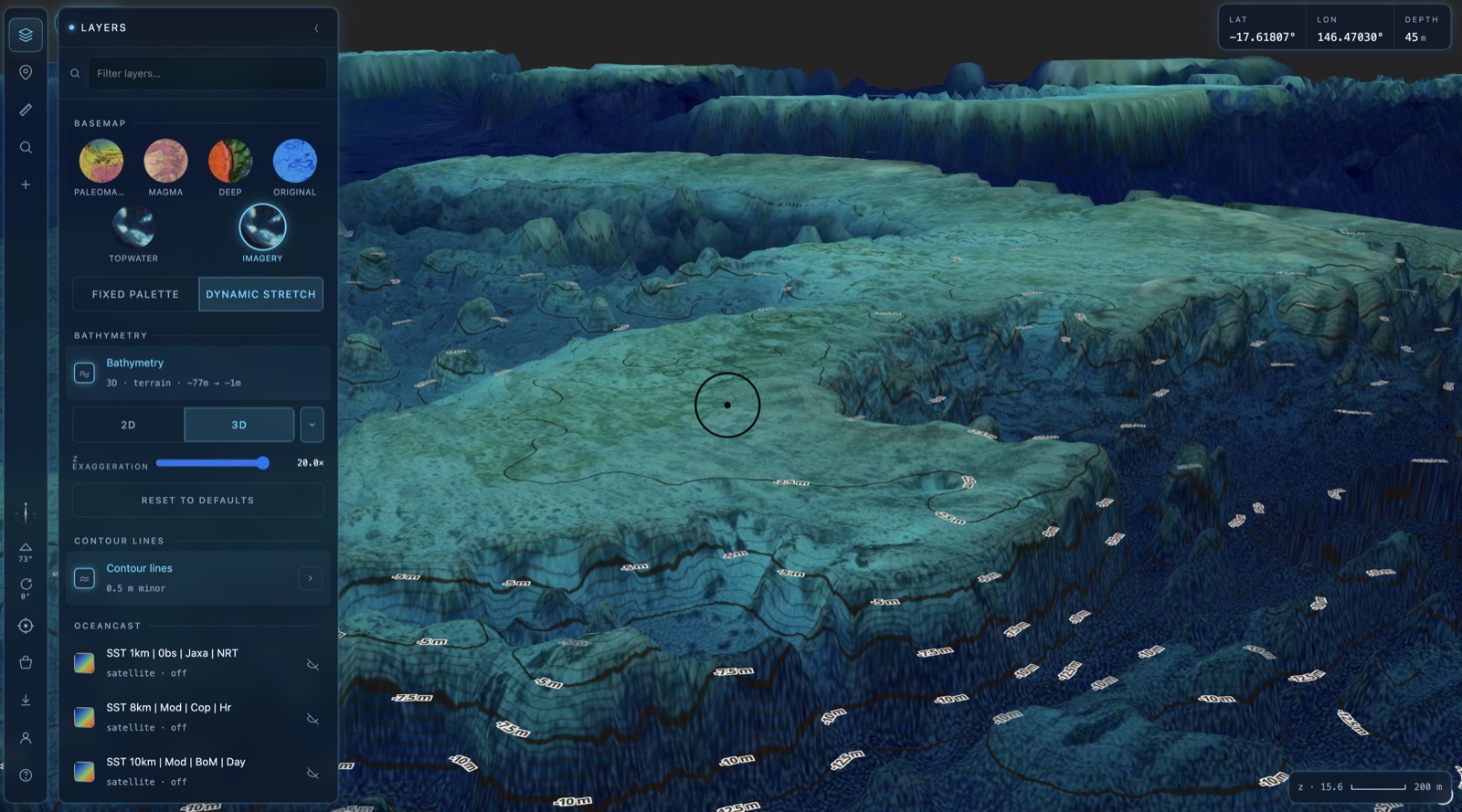
Now see the seabed in full 3D.
Detailed shaded-relief mapping built for Aussie fishermen — now with live 3D terrain, high-res satellite imagery and OceanCast forecast layers. The clearest read on structure you've ever had.
★ 3D terrain
★ High-res imagery
★ OceanCast
−17.61807°, 146.47030° · 3D · 20×
Choose the BathyMaps Premium option that suits the way you fish.
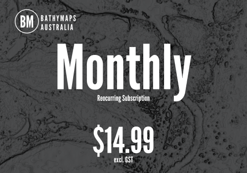
Membership
Monthly ©
The monthly subscription renews every month and can be cancelled at anytime.
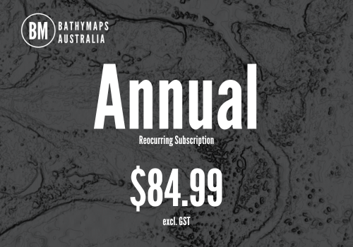
Membership
Annual ©
Save 50% on the monthly subscription with the annual subscription, which renews annually and can be cancelled at anytime.
Three big upgrades, live now in BathyMaps Premium.
Just Released · 3D
3D is here — see the same ground in 2D and 3D.
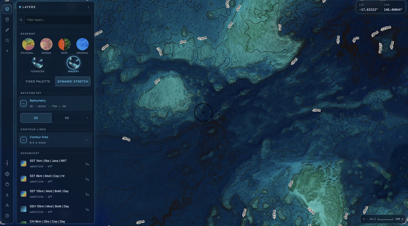
Our biggest release yet. Flick the new 3D toggle and the bathymetry rises into living terrain — every ledge, pinnacle, lump and bump. Read your contours and depths in flat 2D, then tilt into full 3D to see exactly how the structure stacks up.
BATHYMETRY · 2D ⇄ 3D · UP TO 20×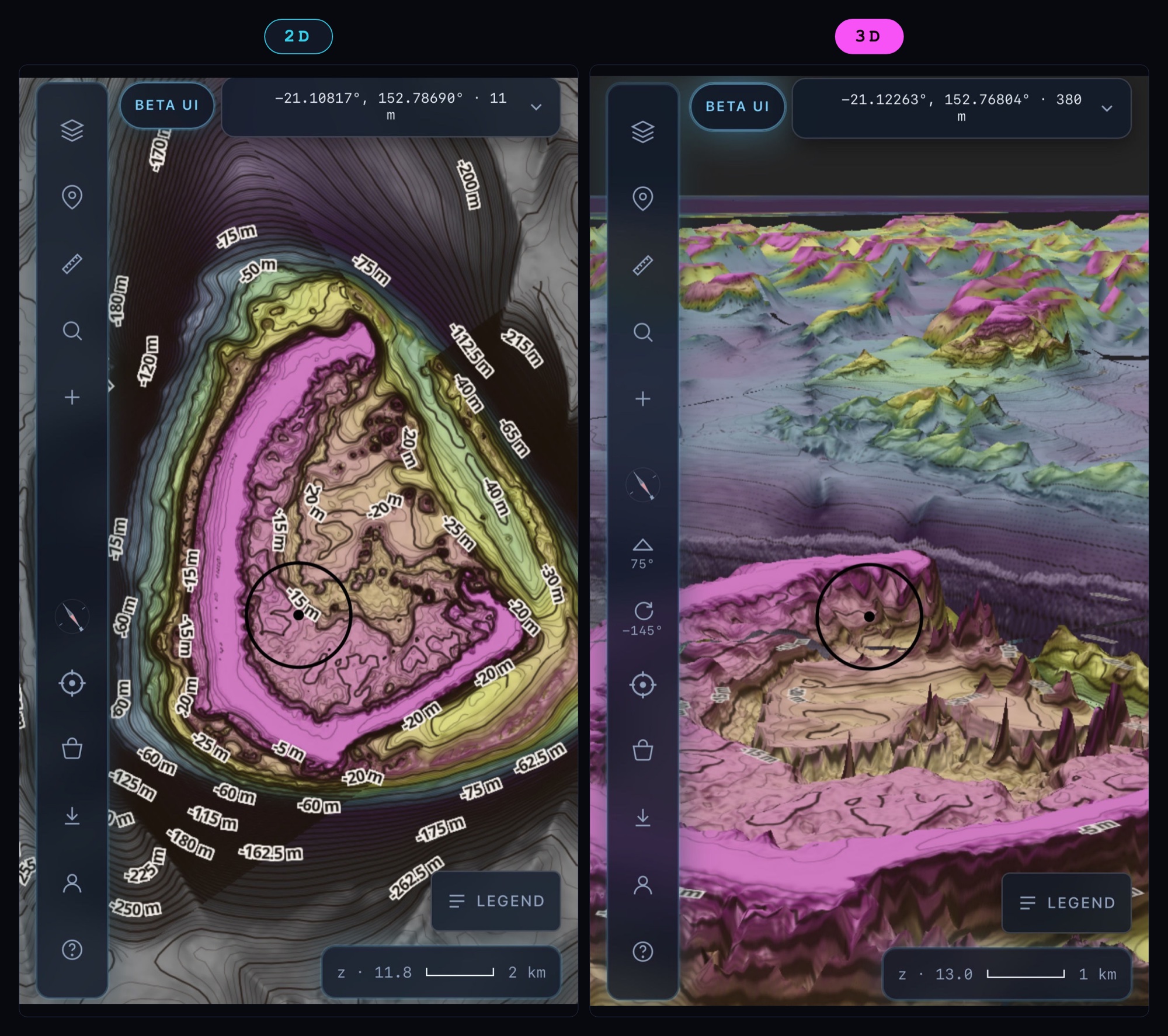
New · Imagery
High-res satellite imagery, draped over the reef.
A brand-new IMAGERY basemap brings crystal-clear satellite detail to the map — every sand patch, bommie and coral edge. Switch it into 3D and the imagery wraps straight over the terrain. It looks unreal.
BASEMAP → IMAGERY · 2D & 3D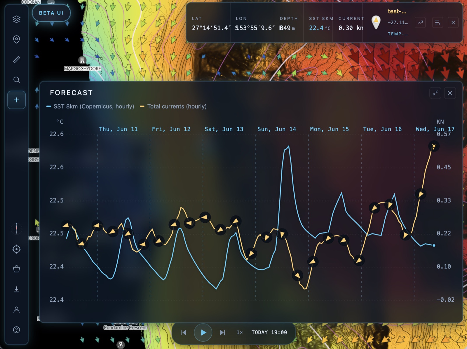
OceanCast
Live ocean data, right where you fish.
OceanCast layers bring real-time and forecast sea surface temperature, sea surface height, chlorophyll and total currents — integrating ocean, tidal and wind currents for a complete picture of conditions before you head out.
SST · SSH · CHL · TOTAL CURRENTS
Mapping built around the way recreational fishermen actually plan.
BathyMaps is a bathymetry-based mapping company that aims to provide fishermen-focused maps. Our maps use the most recent and highest resolution bathymetry data available. We enhance our bathymetry data to highlight subtle depth changes for optimal identification of seabed structure. We understand that no single map can fit everyone's needs, so we have developed multiple maps to accomodate different fishing strategies.
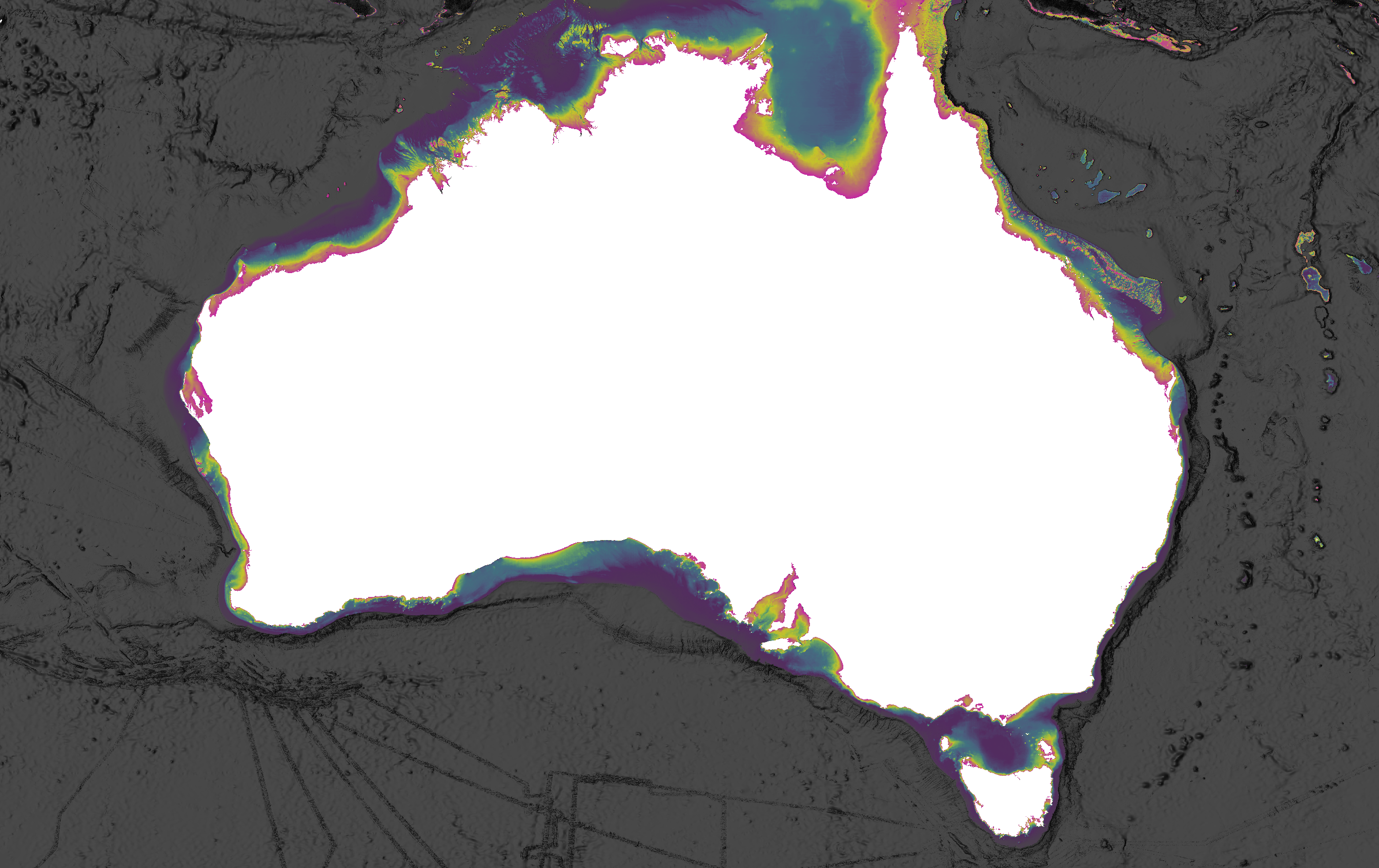
Coverage
BathyMaps Coverage ©
BathyMaps Premium covers all Australian Waters.
BathyMaps Premium is trusted by thousands of Anglers across Australia.
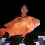
Premium User
Tyler
BathyMaps Premium in conjunction with a good sounder is what found these fish, 100%.
View on Instagram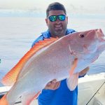
Premium User
Jason
So much to explore, so much to find, anticipation of fidning new ground is exciting thanks to BathyMaps Premium.
View on Instagram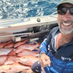
Premium User
Mick
I used BathyMaps Premium to find these new marks and got onto some nice nannys.
View on Instagram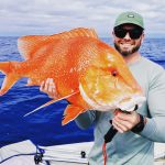
Premium User
Tom
Great for planning trips and finding fish holding structure.
Instagram
Follow BathyMaps
Follow BathyMaps Australia on Instagram.
Stay close to the trips, catches and new ground the community is finding with BathyMaps Premium.